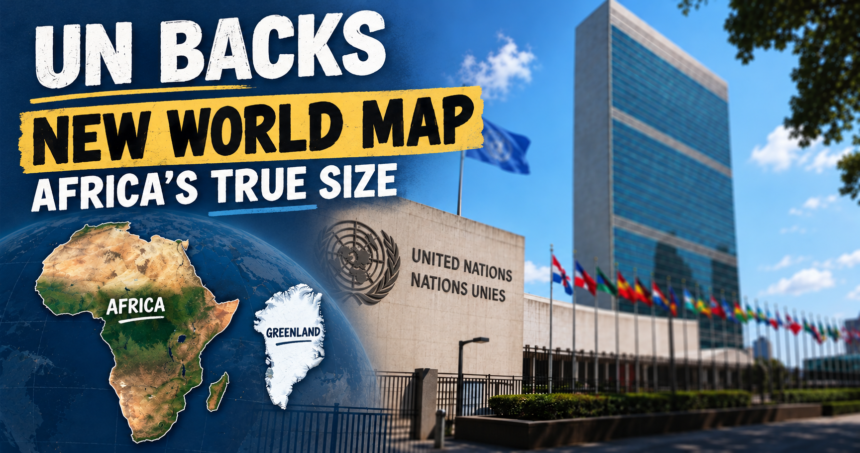
The United Nations General Assembly came up with a new world map designed to represent the size of Africa and other continents more accurately, challenging the centuries-old projection commonly used in classrooms, media and digital platforms.
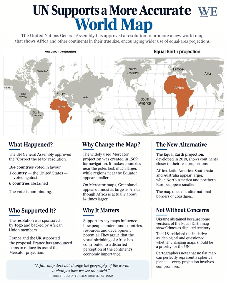
The “Correct the Map” resolution, sponsored by Togo and supported by African Union members, passed with 164 votes in favour, one against and six abstentions. The United States was the only country to oppose the measure. The resolution is non-binding, meaning it does not legally force governments or institutions to abandon existing maps. Instead, it encourages wider use of equal-area projections, particularly the 2018 Equal Earth map.
The campaign focuses on the Mercator projection, created by Flemish cartographer Gerardus Mercator in 1569. The map was designed mainly for navigation because it allows sailors to plot courses using straight lines. However, it greatly enlarges landmasses located near the North and South Poles while making regions near the Equator appear smaller.
One of the clearest examples is Greenland. On many Mercator maps, Greenland appears almost as large as Africa. In reality, Africa is approximately 14 times larger than Greenland. The distortion also makes countries such as Canada, Russia and parts of Europe appear much bigger relative to tropical regions.
Supporters of the resolution argue that maps influence how people understand the world. They say the visual shrinking of Africa has contributed to a distorted perception of the continent’s economic importance, resources and development potential.

“A fair map does not change the geography of the world; it changes how we see the world,” Togo’s Foreign Minister Robert Dussey said before the vote. France also announced plans to stop using the Mercator projection for its world map.
The Equal Earth projection presents continents in closer proportion to their actual land areas. Africa, Latin America, South Asia and Australia appear larger, while northern regions are reduced. The map does not alter national borders or coastlines.
Not every country supported the resolution without reservations. Ukraine abstained because some versions of the Equal Earth map show Crimea as disputed territory. The U.S. criticised the initiative as ideological and questioned whether changing maps should be a priority for the UN.

Cartographers stress that no flat map can perfectly represent a spherical planet. Every projection involves compromises involving area, shape, distance or direction. Mercator remains useful for navigation, but the UN vote encourages schools, governments and technology companies to use more accurate alternatives when comparing the size of continents.